/

Space4Maritime: diving into space-based solutions for the maritime domain

Recently, Eurisy launched the initiative Space4Maritime. The objective is to identify and understand the needs of European maritime end-user communities, facilitating the dialogue with the space industry and the uptake of satellite services. In this frame, Eurisy started a series of interviews with end-users identified in the blue world. The result of these interviews is the core of the paper. The overall objective is to identify the existing operational solutions applicable in the maritime domain through practical examples, as well as the bottlenecks that harness the potential of satellite applications for the sustainable growth of the Blue Economy.

The paper will mainly address service providers and public authorities, providing them with a set of recommendations on how to foster cooperation with maritime operators. But it also targets potential new end-users interested in adopting satellite solutions in their workflow. The case studies will be complemented further by additional information collected through desk research and the organization of thematic webinars.

/

Improving STEAM Education in Secondary Schools through the co-creation of new methodologies for teaching GIS products related to climate impact on local communities

The improvement of STEAM education in secondary schools is the core objective of the Erasmus+ funded project “GIS4Schools”, which aims at promoting a new innovative approach to foster the teaching of STEAM subjects in secondary schools across four different European countries: Italy, Portugal, Romania, and Spain. The project intends to introduce the education of GIS and satellite technologies for Earth Observation- rarely adopted in secondary schools- and applying them to the thematic area of Climate Change.

The paper will illustrate the genesis of the project, and more specifically, the process leading to the development of training packages for secondary schools’ teachers and pupils. Furthermore, the paper will explore which methodology and pedagogic approach must be adopted to transfer new knowledge from teachers to pupils. The paper will also describe how the teaching of GIS and satellite technologies for Earth observation in secondary school can impact pupils’ perception of STEAM subjects and how this can impact their future academic careers. Specific attention will also be dedicated to the description of the innovative tools developed and applied for monitoring and evaluation.

/

Messages to the above: Looking at art from the sky

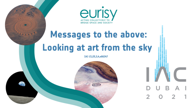
What’s the interest of realising an artwork that can only be appreciated in its entireness from the sky? Apparently, none. Nevertheless, giant artworks perceivable only from above have been realised since the most ancient times, while the history of architecture counts endless examples of sophisticated buildings, castles, gardens and the like, which plan or ichnography can be only seen clearly by watching at them downward from above.
This article wants to provide our readers with a short introduction on how aerial photography and satellite imagery have changed our way of looking at the Earth, inspiring art movements and allowing for the discovery and appreciation of ancient and more recent artworks, be them nature-made or man-made.

/

A closer look into satellite-based solutions fighting Covid-19

The COVID-19 pandemic heavily impacted different aspects of our life. Since the early outbreak technology is being brought to the forefront to limit infections, enabling effective recovery responses, providing reliable information to a diverse set of stakeholders, and observing the effects of the lockdown. This report aims at presenting five examples of satellite-based solutions tackling a wide range of challenges that enabled citizens and public authorities to make informed decisions during the global pandemic outbreak. To conclude this overview, a list of recommendations to favour the uptake of satellite-based solutions by public authorities has been defined.

/

Space for Cities Report: From innovation to operation


The report contains the main messages from the Space for Cities Workshop “From innovation to operation: A talk about concrete uses of satellite data and services to support cities’ resilience and sustainability”. It covers the opportunities and challenges related to the uptake of operational satellite-based services in cities as presented by the different speakers during the workshop.

/

UN/Austria Symposium: User-centric satellite solutions for effective climate actions

The 2020 UN/Austria Symposium “Space Applications for Sustainable Development Goal 13: Climate Action” took place from 1-3 September 2020.

The event aimed to showcase concrete climate action cases through demonstrations of applications using space solutions. Users of space applications presented lessons learnt and experts discussed the role of space applications in climate-related policies. On the 2nd of September, Eurisy gave a presentation on the basis of this abstract.

COVID-19 Tracing Apps and Data Protection

Eurisy and the Space Generation Advisory Council (SGAC) decided to join forces to organise a webinar on the legal consequences related to the use of tracing apps during the first phase of the de-confinement. Find out which existing space-based apps can help track the spread of COVID-19, and what the legal issues are with regard to privacy. The purpose of the webinar was to present the audience operational space-based apps that could help trace patients, as well as to reflect upon data protection and other challenges. Read the full report here.

/

Fostering the use of satellite Remote Sensing to support Plant Health surveillance activities

On the occasion of the United Nations International Year of Plant Health 2020, Eurisy and Euphresco join forces to promote the operational use of Satellite Remote Sensing to detect, monitor and fight plant pests.

Despite the proven potential of satellite data to guide and instruct on ground surveillance activities and other phytosanitary measures of the National Plant Protection Organisations, practical use of Remote Sensing for Plant Health is still very limited in Europe. To favour the transfer of space technologies to the Plant Health community, Remote Sensing data must be made easily available to National Plant Protection Organisations and be adapted to their needs. For this to happen, new sensors, platforms, and information flows are to be built.

/

Satellites Going Local – Culture Edition

 In this 6th edition of our Satellites Going Local series, Eurisy continues to highlight the contributions of satellite applications for society, this time taking our investigations into the cultural and creative sectors.

This new issue illustrates how satellite based technologies in particular are being used to better manage historical cities, monitor and safeguard cultural heritage and enable creative minds to generate new ways to experience culture.

The stories collected are meant to stimulate awareness and exchange of knowledge among those who are already using satellite applications and those who are interested in them. They also aim to inspire public and private actors to come up with increasingly innovative and useful services in the cultural and creative sectors.

Load more