Ekodenge: Copernicus data and services to SHELTER cultural heritage
Ekodenge
Ekodenge is a Turkish SME with a team of sustainability experts, providing consultancy, engineering, architecture, and software solution services.
Created in 1996, Ekodenge is headquartered in Ankara, at the Hacettepe Technopark research and business centre. The company can count on a multi-disciplinary team of 40 people, including architects, chemical, environmental and mechanical engineers.
The challenge
Climate change is exposing historical and cultural sites to threats such as floods, wildfires and heatwaves, among others. Data on land cover is critical to understand these hazards, as well as to monitor changes around cultural heritage sites.
Even though spatial information becomes more and more abundant thanks to global Earth Observation (EO) systems, spatial data collected by different entities for different regions of the world still lack standardisation and harmonisation.
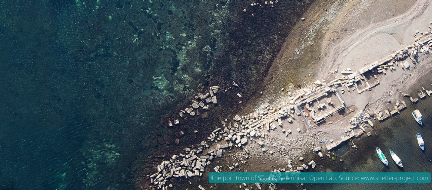
Since 2019 Ekodenge is part of the Consortium implementing the Horizon 2020 SHELTER project (Sustainable Historic Environments holistic reconstruction through Technological Enhancement and community-based Resilience). The project involves 23 partners from 10 countries.
SHELTER includes five test beds, representing the main climatic and environmental challenges in Europe and different heritage’s typologies.
Ekodenge is responsible for creating a risk assessment tool visualised on a Geographic Information System (GIS), containing information on land use, that can used to foresee resilience and threats to the heritage and to plan recovery measures. To do this, Ekodenge needs accurate information on land cover in the sites targeted by the project.
The satellite solution
To build the platform for disaster risk management in the areas targeted by the project, Ekodenge uses data on land cover and climate and historical data from the Sentinel-1 and Sentinel-2 satellites of the Copernicus programme.
The historical data allow them to retrace soil movements, changes in landcover, and weather events, such as heatwaves and floods, that damaged the cultural heritage sites in the past. These data are integrated in the datadriven platform for disasters risk management produced within the project.
The Copernicus data is particularly useful for this kind of assessments, since the data are freely available across Europe and accessible in the same format. This means that the data acquired through Copernicus allow Ekodenge to calibrate all different and site-specific data to be used into the same platform. Moreover, the information contained in the platform for each site can be easily compared and updated.
The results
Thanks to Copernicus data, Ekodenge can acquire data on land cover for the five different areas targeted in the open labs in a harmonised and standardised format.
The platform not only includes information relevant for safeguarding cultural heritage, but also for protecting natural heritage and human settlements from natural disasters and climate change at the regional level.
The GIS platform developed by the partners of the SHELTER project will contribute to building a model to improve the resilience of cultural heritage sites through better decision-making processes and policies applicable at local and regional levels.
All data will be made available on an IT platform after the project ends in 2023. Based on the information regrouped in the platform, the project partners will propose measures to increase the resilience of cultural heritage sites and make recommendations on “building back better” techniques.
The platform is intended to be used by all the stakeholders operating in the sites targeted by the SHELTER project, such as policymakers, fire brigades, construction companies, and research institutes.